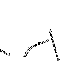
7 WINTHROP STREET
Owner Information
STEIN RICHARD B & RHONDA L
7 WINTHROP STREET
NORTH EASTON, MA 02356


Property Details
7 WINTHROP STREET is classified as a Single Family Residential (Ranch).
The primary structure on this property was built in 2014. There are 4,488ft2 of built area within this property. There is 1,867ft2 of residential/living space within this property. This property is listed as having 4 rooms.
7 WINTHROP STREET is valued at $515,200. The land is valued at $238,100 and the structures are valued at $276,000. There is an additional valuation of $1,100 on this property.
This property is in Zone IND. Confirm with local Zoning Board authorities to ensure there are no overlays or other easements on this property.
The most recent deed for 7 WINTHROP STREET is recorded at the local registrar in Book 21642, Page 0051. 7 WINTHROP STREET was last sold on Wednesday, April 23, 2014 for $402,726.
Assessment data from fiscal year 2022.
Flood Data
According to the FEMA National Flood Hazard Layer, this property does not appear to be in a flood zone. It may also be in an area not yet reviewed. Nonetheless, confirm this information prior to taking any action.
To view the flood hazards around this property, create a FEMA "Firmette" Map of the area around 7 WINTHROP STREET.
Broadband Internet Providers
| Provider | Type | Bandwidth (mbps) | |
|---|---|---|---|
| Verizon New England Inc. | Fiber | 940 | 880 |
| Viasat Inc | Satellite | 100 | 3 |
| Comcast | Cable | 1000 | 35 |
| GCI Communication Corp. | Satellite | 0 | 0 |
| HughesNet | Satellite | 25 | 3 |
| VSAT Systems, LLC. | Satellite | 2 | 1 |
Broadband service provider data from December 2020.
Adjacent Properties
- 17 HANCOCK STREET
Undevelopable Residential Land owned by WELCH DENNIS TRUSTEE - 15 SHANNONMARIE WAY
Single Family Residential owned by GREENE JR JAMES R & LINDA J - 17 SHANNONMARIE WAY
Single Family Residential owned by SMITH BRUCE AND HILARY - 5 WINTHROP STREET
Single Family Residential owned by LUIZZI PAUL J JR & KATHLEEN E - 9 WINTHROP STREET
Single Family Residential owned by HEENAN THOMAS J & MARY C